Via Features
Visualize and analyze MATSim simulations
Visualizing MATSim results
Load and visualize many of MATSim’s default file formats
Via directly supports the loading of the typical MATSim input and output files. Network and facilities from MATSim can easily be visualized. A multitude of data can be extracted by Via from MATSim’s events files, for example vehicle trajectories, activity times and link volumes.
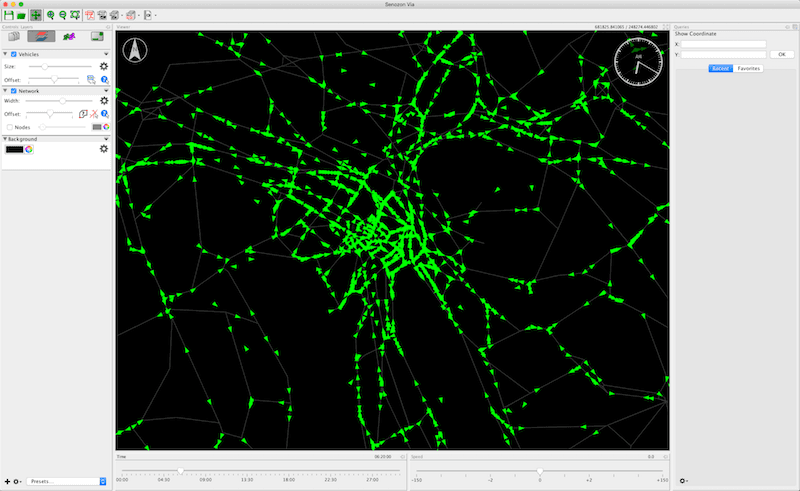
Analyzing MATSim results
Extract a lot of data from MATSim’s events.xml
Using the native MATSim file formats like network, population, facilities and events, Via is capable of calculating many different key aspects of your simulations and providing you access to these data in an easy and configurable way. Via allows you to easily calculate link volumes, see the number of trip starts over the course of a day for different modes, perform select link and select facility analyses, or inspect single agents’ plans.

Analyzing large spatial and temporal data sets
Not only MATSim produces data of objects moving around in time and space, but many other tools as well. GPS recordings and phone call records are more and more commonly available. Analyzing such data with traditional statistical tools often hit a barrier as they do not support the spatial nature of such data very well. GIS software on the other hand often has problems dealing with the temporal attributes of such data. Via, optimized to deal with large such data sets due to the support of MATSim results, is able to visualize and analyze arbitrary data sets with spatial and temporal attributes easily.

… and more
- Display custom ESRI Shape files for enhanced visualizations
- Record screenshots of your visualizations
- Save visualizations as PDF vector graphics
- Define Views and Layer Styles to easily switch between different regions, zoom levels and optimal visualization styles
- Cut networks to smaller regions to create extracts
- Extend Via’s functionality with one or more plugins
